TRAM TRAVELS

City Hall Square (Copenhagen)

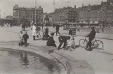
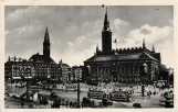
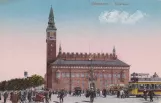
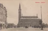
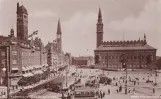
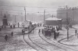
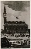
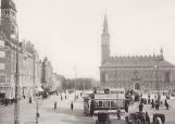
There are 43 photos from City Hall Square (Copenhagen) on Tram Travels.

Copenhagen Tramway (KS) stops

Åboulevard, Ålestrupvej/KB Hallen, Ålholm Plads, Axeltorv, Bispebjerg, Blågårds Plads, Blegdamsvej, Bodenhoffs Plads, Brønshøj, Christiansborg Slotsplads, City Hall Square, Dalgas Boulevard, Degnemose Allé, Dyrehaven, Dyrskuepladsen Bellahøj, Emdrupvej, Enghave Plads, Femvejen, Formosavej, Frederiksberg Runddel, Frederiksholm Sydhavns Plads, Frederiksvej, Frihedsstøtten, Fuglebakken, Gammel Torv, Hans Knudsens Plads, Hellerup, Holmbladsgade, Holmens Kanal, Hovedbanegård, Husum, Islands Brygge, Kammasvej, Klampenborg, Kongens Nytorv, Lille Vibenshus, Mozarts Plads, Nordre Fasanvej, Nørre Farimagsgade, Nørrebro, Nørrebro Station, Nyelandsplads, Øresundsvej, Østerport Station/Oslo Plads, Polititorvet, Rigshospitalet, Ryparken, Sjællandsgade, Slotskroen, Søtorvet, Strandboulevarden, Studiestræde, Sundby, Sundby Hospital, Sundbyvester Plads, Svanemøllen, Taksigelseskirken, Toftegårds Plads, Trianglen, Trommesalen, Valby (Skellet), Vanløse, Vanløse Station, Ved Langebro, and Vibenshus Runddel.

Copenhagen Tramway (KS) depot

Allégade, Århusgade, Enghave remise, Nørrebro Remise/Nørrebrohallen, Sundby Remise, and The old Valby depot.

Frederiksberg Tramway (FS) stops

City Hall Square, Frederiksvej, Fuglebakken, Godthåbsvej, and Nyelandsplads.

Photos and videos from City Hall Square (Copenhagen)
Sporvejsmuseet 50 - Exhibition preparations (2015)
1:01
Sporvejsmuseet 50 - Exhibition preparations (2015)By SporvognDK.
.
Postcard: Copenhagen tram line 8 with bilevel rail car 380 at City Hall Square (1996)Postcard: Copenhagen tram line 8 with bilevel rail car 380 at City Hall Square (1996)SHS Double-decker motor cars no. 380 (Vulcan 1899) and 419 (Larsen 1915), at Rådhuspladsen, around 1925. The double-decker motor cars were from Frederiksberg Sporveje in 1919 and ran on line 8 until 1927 and on line 17 until the line's closure in 1931.By Henrik Boye, John Lundgren, Sporvejshistorisk Selskab (SHS) - .
Line 16 transitions to bus operation (1970)
8:36
Line 16 transitions to bus operation (1970)On 26 April 1970, the Copenhagen tram line 16 switched to bus operation.By SporvognDK - .
Postcard: Copenhagen tram line 6 with articulated tram 876 at Rådhuspladsen (1969)Postcard: Copenhagen tram line 6 with articulated tram 876 at Rådhuspladsen (1969)HT Museum trams and buses Islevdalvej 119, 2610 Rødovre Six-axle Düwag articulated tram /"Düsseldorfer") no. 876 at Rådhuspladsen. 100 of these trams were built for Copenhagen Trams in 1960-68 January 21, 1969.By Henrik Boye, Henrik Effersøe, HT museum - .
Farewell to the old carriages - On a trip with line 16 (1966)
5:00
Farewell to the old carriages - On a trip with line 16 (1966)50 years ago - on 1 May 1966 - Copenhagen's Sporveje decommissioned the last old two-axle carriages. The Tram History Society organized a number of trips on different tram lines - in this film you can see a look back at the trip on 5 June 1966, which took place on line 16.By SporvognDK - .
Postcard: Copenhagen tram line 2 with railcar 706 on City Hall Square (1966)Postcard: Copenhagen tram line 2 with railcar 706 on City Hall Square (1966)Skjoldenæsholm Tram Museum Copenhagen Tramway motor cars no. 706 (KS' main workshop 1952) at the Town Hall Square circa 1966.By Henrik Boye, Sporvejshistorisk Selskab (SHS) - .
Postcard: Copenhagen tram line 14 with railcar 467 on Rådhuspladsen (1965)Postcard: Copenhagen tram line 14 with railcar 467 on Rådhuspladsen (1965)Road trains built in the 1940s in part of used materials.By Henrik Boye, HT museum, Per Bech Petersen - - .
Postcard: Copenhagen City Hall Square (1963)Postcard: Copenhagen City Hall Square (1963)Copenhagen City Hall. The City Hall of Copenhagen. L'Hôtel de Ville de Copenhague. Das Kopenhagener Rathaus.By Grønlund, Henrik Boye - .
A walk around Vesterbro (1960-1970)
6:42
A walk around Vesterbro (1960-1970)Old Vesterbro in the 1960s – Experience Copenhagen before the transformation. 🎧 Listen in! This video features audio from my podcast, "Know Your City", where I, along with archaeologist and city walker Hanne Fabricius (known from the History Quiz on DR), delve into the history of Vesterbro. 📢 The podcast can be heard on all paid podcast and audiobook services – and completely FREE on eReolen! 📽️ In this unique video recording, you see: ✔️ Street life in Vesterbro, as it looked over 60 years ago ✔️ Trams, small shops, and everyday life in Copenhagen ✔️ People on the streets – from children playing to adults on their way to work 📜 Do you want to delve deeper into history? Listen to the entire episode of "Know Your City" and learn more about Vesterbro's development over the years. 🔔 Subscribe for more historical recordings! Original clip: City Engineers Directorate film collection, TMF film. The clip has been restored to 2K resolution and interpolated to 60 FPS using artificial intelligence. The most important thing about Vesterbro is that what is today called Vesterbrogade, which partly lies on old country roads or the old main road—since roads change over time—is that the original country road into the city port dates back, let's say, to the Viking Age. That’s where most of Zealand originally came from. If you're from Funen, Jutland, Lolland, Falster, Germany, England, and so on, you're coming through the Middle Ages along that country road into Vesterport. Picture yourself arriving from the countryside and looking down toward the island where the fish market and houses are today—the old shoreline actually ran along Halmtorvet and Sønderboulevard. Previously, there was a sea view when entering the city. Large green fields, cattle, and grass once lined the area. We know from the 13th century that the city's citizens could pasture their cattle without paying grazing taxes, which were a tax on the city's common land. The term 'fælledpakken,' which is preserved in Amarfælde, refers to the city's shared grazing area. As for Vesterbro, as we know it today, it appears like a big bridge guard. When did it start taking shape? It actually only formed in the latter half of the 19th century, after 1852, when the military demarcation line was moved. This line arose after the Swedish siege of 168-60—when they burned parts of Vesterbro, among other areas. After they withdrew, the city required protection, so they established a demarcation zone—a kind of invisible line. Initially, it was positioned inside the lakes, extending to Copenhagen's fortifications—Vestervold, Nørrevold, and Østervold—where only low, lightweight buildings could be constructed. This was because, in the event of an attack, these areas could be burned to prevent enemy access. It was effective for its purpose until the English arrived in 1807, when they established a British military presence of 30,000 soldiers around Copenhagen. Once they left, the line was moved outward—roughly to where Karlsberg is today—and followed Pileal, Allegade, Jagtvej, all the way to Falkoneralæ and out to Øresund. This larger zone only permitted low-rise, light buildings—anything except brick or stone, just a single story. That might have worked well in the 18th century, but by the 19th century, industrialization and population growth caused a boom. People poured into the city from the countryside, especially from the west, and expanded beyond Copenhagen's walls. The town was exploding—adding floors to existing buildings, extending into backyards—and eventually, space became scarce. In 1852, it was evident that the existing arrangement was unsustainable. The demarcation line was moved back to the lakes—restoring the original line—and by 1870, it was abolished entirely as Copenhagen's fortifications were dismantled. After that, from 1852 to the 1920s, there was significant development along the bridge crossings. For comparison, Vesterbro’s population grew from 1,711 in 1841 to 6,500 by 1901. Once the demarcation line was gone, streets were laid out over the old field ditches, building on both sides—and that’s when it became quieter and more peaceful. But then came explosive growth, and they filled in the water. In the 1890s, Vesterbro’s terrain was doubled with land reclamation. Specifically, they filled in Langshavej—an entire stretch—so if you're arriving by train in Copenhagen, you might imagine spotting a Viking ship sticking its nose up between the tracks. This history is closely tied to Vesterbro's development, especially the amusement park scene. The story starts in the 17th century, with the emergence of the first amusement parks in the 18th century. Picture that in Vesterbro, there were once large plots of land, which at some point during the 18th century were divided into two big pieces of land.By Kend Din By - - .
Postcard: Copenhagen tram line 2  at City Hall Square (1960)Postcard: Copenhagen tram line 2 at City Hall Square (1960)By Henrik Boye.
.
Postcard: Copenhagen tram line 2 on Rådhuspladsen (1960)Postcard: Copenhagen tram line 2 on Rådhuspladsen (1960)By Henrik Boye, K. Mandker.
.
Postcard: Copenhagen tram line 6 with railcar 266 on Rådhuspladsen (1959-1961)Postcard: Copenhagen tram line 6 with railcar 266 on Rådhuspladsen (1959-1961)Tram Museum Skjodenæsholm City Hall Square in Copenhagen circa 1960. Railcar no. 266 was built by Scandia in 1907 and rebuilt at the Copenhagen Tramway's main workshop in 1927. It ran until 1966. 38By Henrik Boye, Sporvejshistorisk Selskab (SHS) - - .
Postcard: Copenhagen City Hall Square (1957)Postcard: Copenhagen City Hall Square (1957)Copenhagen. Town Hall Copenhagen The TownhallBy Henrik Boye, J. Chr. Olsen Kunstforlag - .
Postcard: Copenhagen night line C  on City Hall Square (1956)Postcard: Copenhagen night line C on City Hall Square (1956)Tram Museum Skjoldenæsholm Due to the petrol strike in March/April 1956, the one-man buses on night line C were replaced by trams from line 6, which ran without line signs.By Henrik Boye, John Lundgren, Sporvejshistorisk Selskab (SHS) - .
Matchbox: Copenhagen on Rådhuspladsen (1955)Matchbox: Copenhagen on Rådhuspladsen (1955)By Henrik Boye.
.
Matchbox: Copenhagen tram line 2  on City Hall Square (1955)Matchbox: Copenhagen tram line 2 on City Hall Square (1955)By Henrik Boye.
.
Prescription envelope: Copenhagen near City Hall Square (1948)Prescription envelope: Copenhagen near City Hall Square (1948)Raadhusapoteket Vestervoldgade 86 (at the corner of Stormgade) Tel.: C.8109 (Night delivery) - and C.10802 Delivery: day and night. Line: 1 * 2 * 5 * 6 * 8 * 10 * 19 and 30 to the doorBy Henrik Boye, Raadhus Apoteket - .
Postcard: Copenhagen at City Hall Square (1947)Postcard: Copenhagen at City Hall Square (1947)Copenhagen City HallBy Henrik Boye, Rudolf Olsen Kunstforlag - .
Drawing: Copenhagen tram line 11  on City Hall Square (1946)Drawing: Copenhagen tram line 11 on City Hall Square (1946)SHS Tram Museum Skjoldenæsholm Lines 11 and 19 were operated by the so-called scrap cars from the lines' establishment in 1944 and 1943, respectively, until 1950. For the rest of the lines' lifespan, they were operated only by old stock.By Henrik Boye, John Lundgren, Sporvejshistorisk Selskab (SHS) - .
Last Tram. Gunnar Lemvigh with Emsemble. Copenhagen (1941)
6:55
Most viewed -
Last Tram. Gunnar Lemvigh with Emsemble. Copenhagen (1941)Last Tram is a Danish comedy record that makes fun of the overcrowded trams, which were running for the last time just after midnight during World War II in Denmark. Gunnar Lemvigh (1909-1979) was a Danish singer, comedian, and movie actor. He appeared in 52 films between 1939 and 1977. Recorded several 78rpm records during the 1940s. Aage Juhl Thomsen (1899-1979), a popular Danish band leader, was also one of the pioneers of Danish jazz in the late 1920s and the 1930s.
Postcard: Copenhagen City Hall Square (1940)Postcard: Copenhagen City Hall Square (1940)By Henrik Boye, Rudolf Olsen Kunstforlag.
.
Postcard: Copenhagen on Rådhuspladsen (1938)Postcard: Copenhagen on Rådhuspladsen (1938)By Henrik Boye, K. Witt-Møllers Kunstforlag.
.
Postcard: Copenhagen tram line 1  at City Hall Square (1936)Postcard: Copenhagen tram line 1 at City Hall Square (1936)Copenhagen, City HallBy Henrik Boye, Rudolf Olsen Kunstforlag - .
Postcard: Copenhagen City Hall Square (1934)Postcard: Copenhagen City Hall Square (1934)Copenhagen City HallBy Henrik Boye, Rudolf Olsen Kunstforlag - .
Postcard: Copenhagen City Hall Square (1933)Postcard: Copenhagen City Hall Square (1933)Copenhagen City HallBy Henrik Boye, Rudolf Olsen Kunstforlag - .
Postcard: Copenhagen tram line 1  on City Hall Square (1933-1938)Postcard: Copenhagen tram line 1 on City Hall Square (1933-1938)By Henrik Boye, Rudolf Olsen Kunstforlag.
- .
Postcard: Copenhagen City Hall Square (1930-1935)Postcard: Copenhagen City Hall Square (1930-1935)By Henrik Boye.
- .
Postcard: Copenhagen tram line 17 with railcar 399 on Rådhuspladsen (1929-1931)Postcard: Copenhagen tram line 17 with railcar 399 on Rådhuspladsen (1929-1931)Skjoldenæsholm Tram Museum Double-decker, former Frederiksberg carriage no. 399 (ex FS 10, Larsen 1899) at Rådhuspladsen circa 1930. Line 17 was closed in 1931. 42By Henrik Boye, Sporvejshistorisk Selskab (SHS) - - .
Postcard: Copenhagen tram line 2  on City Hall Square (1925)Postcard: Copenhagen tram line 2 on City Hall Square (1925)By Henrik Boye, Peter Möller.
.
Postcard: Copenhagen tram line 1  at City Hall Square (1920)Postcard: Copenhagen tram line 1 at City Hall Square (1920)By Henrik Boye, J. Chr. Olsen Kunstforlag.
.
Postcard: Copenhagen City Hall Square (1919-1921)Postcard: Copenhagen City Hall Square (1919-1921)Town Hall Square "Canon photographer circa 1920.By Henrik Boye, Holger Damgaard, Politikens Pressefoto - - .
Postcard: Copenhagen Main line  on City Hall Square (1919)Postcard: Copenhagen Main line on City Hall Square (1919)By Henrik Boye.
.
Postcard: Copenhagen tram line 1  on City Hall Square (1918-1925)Postcard: Copenhagen tram line 1 on City Hall Square (1918-1925)By Henrik Boye, Rudolf Olsen Kunstforlag.
- .
Postcard: Copenhagen City Hall Square (1917)Postcard: Copenhagen City Hall Square (1917)Copenhagen City HallBy Henrik Boye - .
Postcard: Copenhagen Main line with bilevel rail car 397 on City Hall Square (1917)Postcard: Copenhagen Main line with bilevel rail car 397 on City Hall Square (1917)By ED. F. PH, Henrik Boye.
.
Postcard: Copenhagen Main line  on City Hall Square (1916-1918)Postcard: Copenhagen Main line on City Hall Square (1916-1918)By Henrik Boye, Holger Damgaard, Politikens Pressefoto.
- .
Postcard: Copenhagen Main line  on City Hall Square (1916)Postcard: Copenhagen Main line on City Hall Square (1916)By Henrik Boye, Stenders Forlag.
.
Postcard: Copenhagen tram line 14  on City Hall Square (1915-1920)Postcard: Copenhagen tram line 14 on City Hall Square (1915-1920)By Henrik Boye.
- .
Postcard: Copenhagen Main line  on City Hall Square (1903-1905)Postcard: Copenhagen Main line on City Hall Square (1903-1905)By Det Kongelige Bibliotek (KB), Henrik Boye, Irenco Robert Bier.
- .
Postcard: Copenhagen Main line  at City Hall Square (1900)Postcard: Copenhagen Main line at City Hall Square (1900)By Henrik Boye, Vincents Kunstforlag.
.
Copenhagen K in the old days (1899-1972)
3:10
Copenhagen K in the old days (1899-1972)By Claus Frandsen.
- .
Copenhagen transport now and then (1899-2016)
4:58
Most viewed -
Copenhagen transport now and then (1899-2016)A Copenhagen-mix from modern street views and dito buses with pictures from the former tram-system on the same locations.
KS Copenhagen 4 part (1899-1972)
7:09
KS Copenhagen 4 part (1899-1972)Kongens Nytorv, the world's most beautiful square, as I remember it from my childhood.By Jean MIRÉ MAISON - - .

Location on a map

Add a comment

Last updated: .