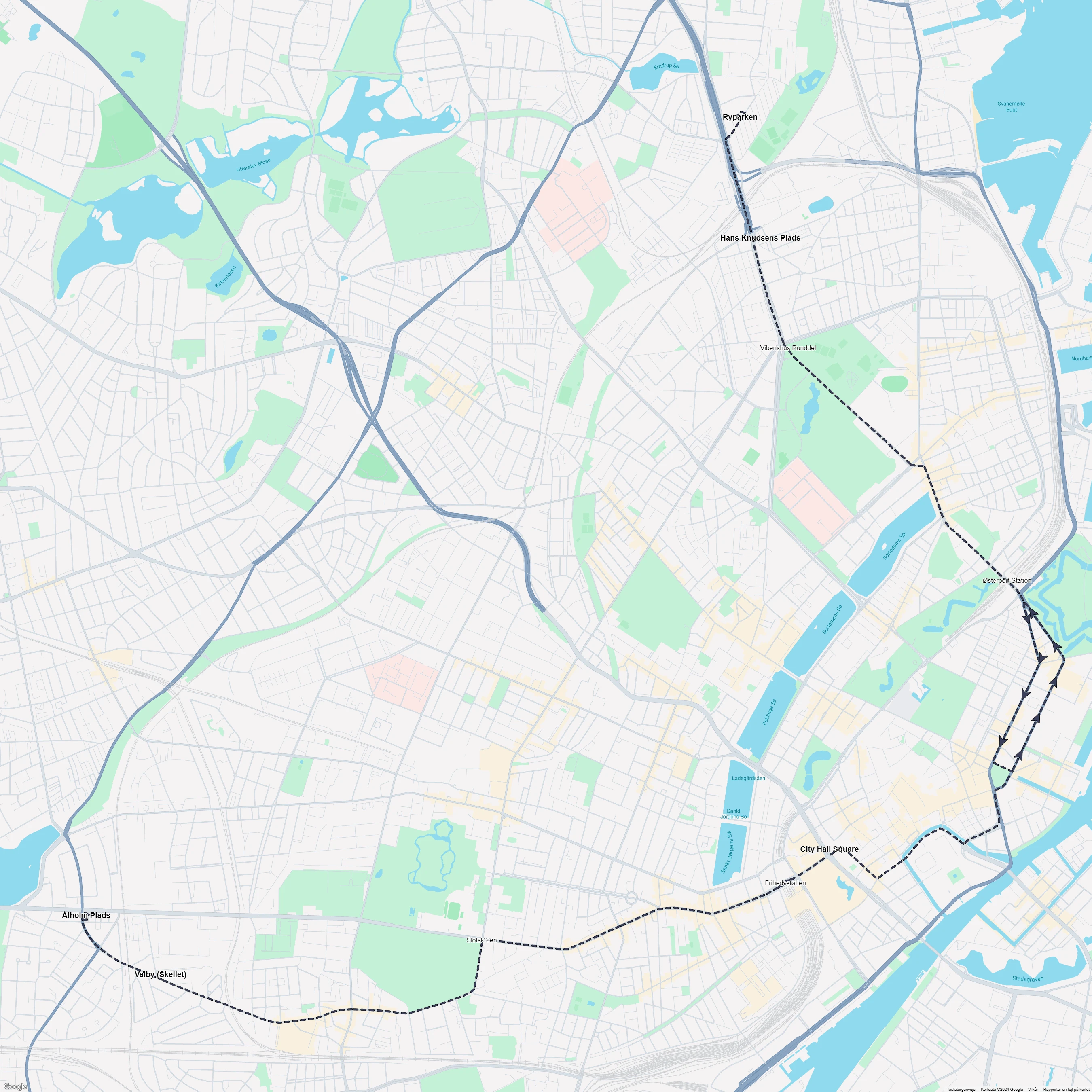
Copenhagen tram line 6: Ålholm Plads - Ryparken
ClosedCity: Copenhagen (Denmark).
Route length: 14.6 km (9.1 miles).
Track gauge: 1435 mm (standard gauge).
Opened: July 22, 1902.
Closed: April 27, 1969.
Lines in Copenhagen
Select line type: Tram lines, battery tram lines, extra lines, horse tram lines, night lines, special event lines, steam tram lines, and tourist lines.
Tram lines in Copenhagen
Frederiksberg Main line: Fuglebakken - Frederiksvej
Closed
Frederiksberg Tværlinie
Closed
Frederiksberg Vanløse line
Closed
Copenhagen tram line 1: Svanemøllen - Ålestrupvej
Closed
Copenhagen tram line 2: Brønshøj - Sundbyvesterplads
Closed
Copenhagen tram line 3: Mozarts Plads - Strandboulevarden
Closed
Copenhagen tram line 4: Svanemøllen - Polititorvet
Closed
Copenhagen tram line 5: Husum - Formosavej
Closed
Copenhagen tram line 6: Ålholm Plads - Ryparken
Closed
Copenhagen tram line 7: Husum - Kongens Nytorv
Closed
Copenhagen tram line 8: Degnemose Allé - Bodenhoffs Plads
Closed
Copenhagen tram line 9: Toftegårds Plads - Holmbladsgade
Closed
Copenhagen tram line 10: Emdrupvej - Toftegårds Plads
Closed
Copenhagen tram line 11: Mozarts Plads - Husum
Closed
Copenhagen tram line 13: Sundby - Vanløse
Closed
Copenhagen tram line 14: Ålestrupvej - Hellerup
Closed
Copenhagen tram line 15: Hans Knudsens Plads - Valby (Skellet)
Closed
Copenhagen tram line 16: Toftegårds Plads - Emdrupvej
Closed
Copenhagen tram line 17: Vanløse - Rådhuspladsen
Closed
Copenhagen tram line 18: Svanemøllen - Toftegårds Plads
Closed
Copenhagen tram line 19: Øresundsvej - Bispebjerg
Closed
Stops
Ålholm Plads → Vibenshus Runddel → Ryparken → Valby (Skellet) → Østerport Station → Frihedsstøtten → City Hall Square → Slotskroen → Hans Knudsens Plads.

View the route map in high resolution.
Photos and videos of Copenhagen tram line 6: Ålholm Plads - Ryparken
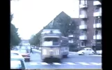
 New video - April 4, 2025
A walk around Vesterbro in the 1960s - Restored in 2K - 50fps.By Kend Din By.
March 28, 2025.
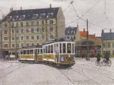 Drawing: Copenhagen tram line 6 with railcar 370 on Trianglen (2002)By Henrik Boye, John Lundgren, Sporvejshistorisk Selskab (SHS).
2002.
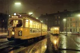
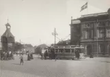
 Postcard: Copenhagen tram line 6 with railcar 587 at Vibenshus Runddel (1969)By Henrik Boye, Sporvejshistorisk Selskab (SHS).
March 27, 1969.
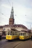
 Postcard: Copenhagen tram line 6 with articulated tram 884 at Kongens Nytorv (1969)By Henrik Boye, Henrik Effersøe, HT museum.
January 22, 1969.
 Postcard: Copenhagen tram line 6 with articulated tram 876 at Rådhuspladsen (1969)By Henrik Boye, Henrik Effersøe, HT museum.
January 21, 1969.
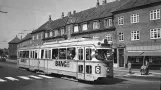
 Postcard: Copenhagen tram line 6 with articulated tram 815 on Bredgade (1967-1969)By Henrik Boye, Sporvejshistorisk Selskab (SHS).
1967 - 1969.
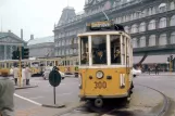 Most viewed foto - November 2024
Postcard: Copenhagen tram line 10 with railcar 300 on Kongens Nytorv (1966)By Henrik Boye, Sporvejshistorisk Selskab (SHS).
April 1966.
 Postcard: Copenhagen tram line 1 with railcar 234 on Vindebrogade (1965)By Henrik Boye, HT museum, Per Bech Petersen.
April 8, 1965.
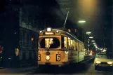
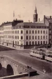
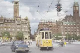 Postcard: Copenhagen tram line 6 with railcar 266 on Rådhuspladsen (1959-1961)By Henrik Boye, Sporvejshistorisk Selskab (SHS).
1959 - 1961.
 Most viewed video - January 2025
Last Tram. Gunnar Lemvigh with Emsemble. Copenhagen 1941By Mads Nielsen.
1941.
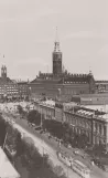
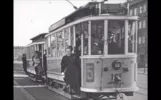
 Postcard: Copenhagen tram line 6 with railcar 159 on Kongens Nytorv (1906)By Henrik Boye, HT museum.
October 1906.