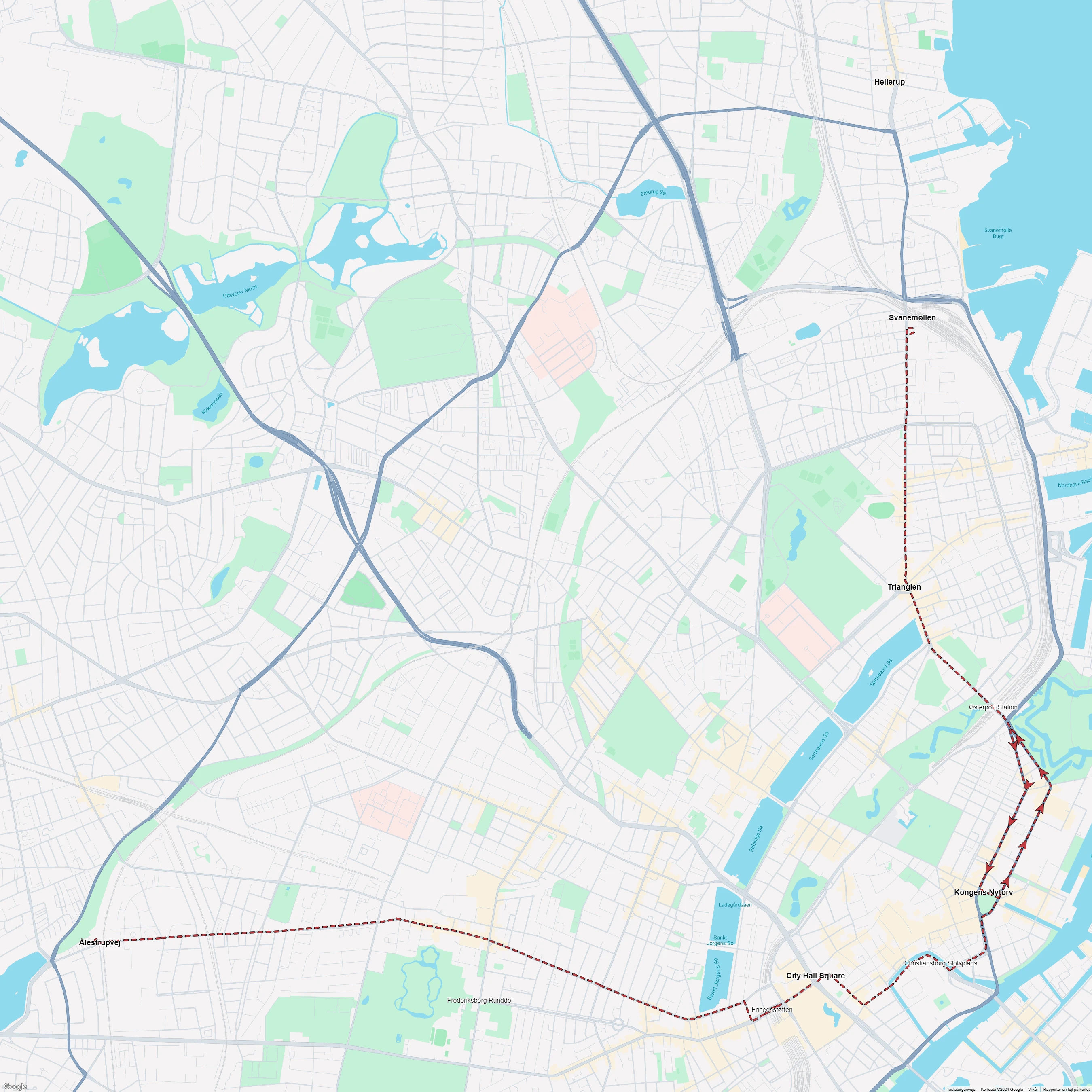
Copenhagen tram line 1: Svanemøllen - Ålestrupvej
ClosedCity: Copenhagen (Denmark), Frederiksberg (Denmark).
Route length: 12.8 km (8 miles).
Track gauge: 1435 mm (standard gauge).
Opened: December 4, 1901.
Closed: April 30, 1967.
Lines in Copenhagen
Select line type: Tram lines, battery tram lines, extra lines, horse tram lines, night lines, special event lines, steam tram lines, and tourist lines.
Tram lines in Copenhagen
Frederiksberg Main line: Fuglebakken - Frederiksvej
Closed
Frederiksberg Tværlinie
Closed
Frederiksberg Vanløse line
Closed
Copenhagen tram line 1: Svanemøllen - Ålestrupvej
Closed
Copenhagen tram line 2: Brønshøj - Sundbyvesterplads
Closed
Copenhagen tram line 3: Mozarts Plads - Strandboulevarden
Closed
Copenhagen tram line 4: Svanemøllen - Polititorvet
Closed
Copenhagen tram line 5: Husum - Formosavej
Closed
Copenhagen tram line 6: Ålholm Plads - Ryparken
Closed
Copenhagen tram line 7: Husum - Kongens Nytorv
Closed
Copenhagen tram line 8: Degnemose Allé - Bodenhoffs Plads
Closed
Copenhagen tram line 9: Toftegårds Plads - Holmbladsgade
Closed
Copenhagen tram line 10: Emdrupvej - Toftegårds Plads
Closed
Copenhagen tram line 11: Mozarts Plads - Husum
Closed
Copenhagen tram line 13: Sundby - Vanløse
Closed
Copenhagen tram line 14: Ålestrupvej - Hellerup
Closed
Copenhagen tram line 15: Hans Knudsens Plads - Valby (Skellet)
Closed
Copenhagen tram line 16: Toftegårds Plads - Emdrupvej
Closed
Copenhagen tram line 17: Vanløse - Rådhuspladsen
Closed
Copenhagen tram line 18: Svanemøllen - Toftegårds Plads
Closed
Copenhagen tram line 19: Øresundsvej - Bispebjerg
Closed
Stops
Svanemøllen → Ålestrupvej/KB Hallen → Frederiksberg Runddel → Frihedsstøtten → Østerport Station → Christiansborg Slotsplads → Kongens Nytorv → City Hall Square → Trianglen → Hellerup.

View the route map in high resolution.
Photos and videos of Copenhagen tram line 1: Svanemøllen - Ålestrupvej
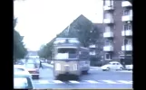
 New video - April 4, 2025
A walk around Vesterbro in the 1960s - Restored in 2K - 50fps.By Kend Din By.
March 28, 2025.
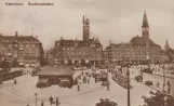
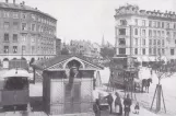
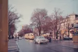 Most viewed foto - 2011
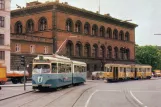
Archive photo: Frederiksberg tram line 1 on Allégade (1967)By Henrik Boye.
February 23, 1967.
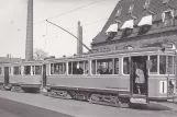
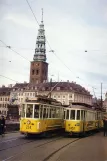 Postcard: Copenhagen tram line 1 with railcar 234 on Vindebrogade (1965)By Henrik Boye, HT museum, Per Bech Petersen.
April 8, 1965.
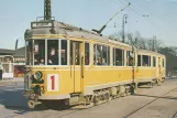
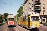 Postcard: Copenhagen tram line 1 with articulated tram 803 at Hellerup (1963-1965)By Henrik Boye, Sporvejshistorisk Selskab (SHS).
1963 - 1965.
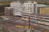
 Postcard: Copenhagen tourist line T with articulated tram 802 on Holmens Kanal (1961)By Henrik Boye, Sporvejshistorisk Selskab (SHS).
1961.
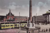
 Postcard: Copenhagen tram line 1 at Frihedsstøtten (1956)By Henrik Boye, Rudolf Olsen Kunstforlag.
1956.
 Postcard: Copenhagen tram line 1 on Østerport Station (1954-1956)By Henrik Boye, Sporvejshistorisk Selskab (SHS).
1954 - 1956.
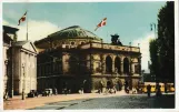 Postcard: Copenhagen tram line 1 by Royal Danish Theatre (1946-1955)By Henrik Boye, K. Witt-Møllers Kunstforlag.
1946 - 1955.
 Postcard: Copenhagen tram line 1 at Rådhuspladsen (1936)By Henrik Boye, Rudolf Olsen Kunstforlag.
1936.
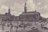
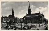
 Postcard: Copenhagen tram line 1 on City Hall Square (1933-1938)By Henrik Boye, Rudolf Olsen Kunstforlag.
1933 - 1938.
 Postcard: Copenhagen tram line 1 with railcar 501 on Strandvejen (1930)By Henrik Boye, HT museum, Københavns Sporveje (KS).
February 5, 1930.
 Postcard: Copenhagen tram line 1 at Rådhuspladsen (1920)By Henrik Boye, J. Chr. Olsen Kunstforlag.
1920.
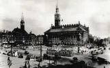
 Postcard: Copenhagen tram line 1 on City Hall Square (1918-1925)By Henrik Boye, Rudolf Olsen Kunstforlag.
1918 - 1925.
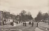 Postcard: Copenhagen tram line 1 at Frederiksberg Runddel (1902)By Alex. Vincents Kunstforlag, Henrik Boye.
1902.
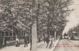 Postcard: Copenhagen tram line 1 with open sidecar 253 on Frederiksberg Allé (1902)By Henrik Boye.
1902.
 Prescription envelope: Copenhagen steam tram line with open sidecar 16 on Trianglen (1886-1888)By Apoteket Trianglen, Henrik Boye.
1886 - 1888.