Transports de l'Agglomération Orléanaise (TAO)
OperationalCity: Orléans (France).
Total route length: 29.3 km (18.2 miles).
Track gauge: 1435 mm (standard gauge).
Opened: .
Trams and light rails worldwide
Select a country: Algeria, Argentina, Armenia, Australia, Austria, Azerbaijan, Belarus, Belgium, Bosnia and Herzegovina, Brazil, Bulgaria, Canada, Chile, China, Croatia, Cuba, Czech Republic, Denmark, Ecuador, Egypt, Estonia, Finland, France, Georgia, Germany, Greece, Guyana, Hungary, India, Ireland, Israel / Palestine, Italy, Japan, Kazakhstan, Latvia, Lebanon, Lithuania, Luxembourg, Mexico, Morocco, Netherlands, New Zealand, North Korea, Norway, Paraguay, Peru, Philippines, Poland, Portugal, Romania, Russia, Serbia, Slovakia, South Africa, Spain, Sweden, Switzerland, Tunisia, Turkey, Ukraine, United Arab Emirates, United Kingdom, United States, Venezuela, and Vietnam.
Trams and light rails in France
Select a city: Angers, Avignon, Besançon, Bordeaux, Brest, Colmar, Dijon, Grenoble, Le Mans, Lille, Lyon, Marseille, Montpellier, Mulhouse, Nantes, Nice, Orléans, Paris, Perpignan, Reims, Rouen, Saint-Étienne, Strasbourg, Toulouse, Tours, and Valenciennes.
Tram lines in operation
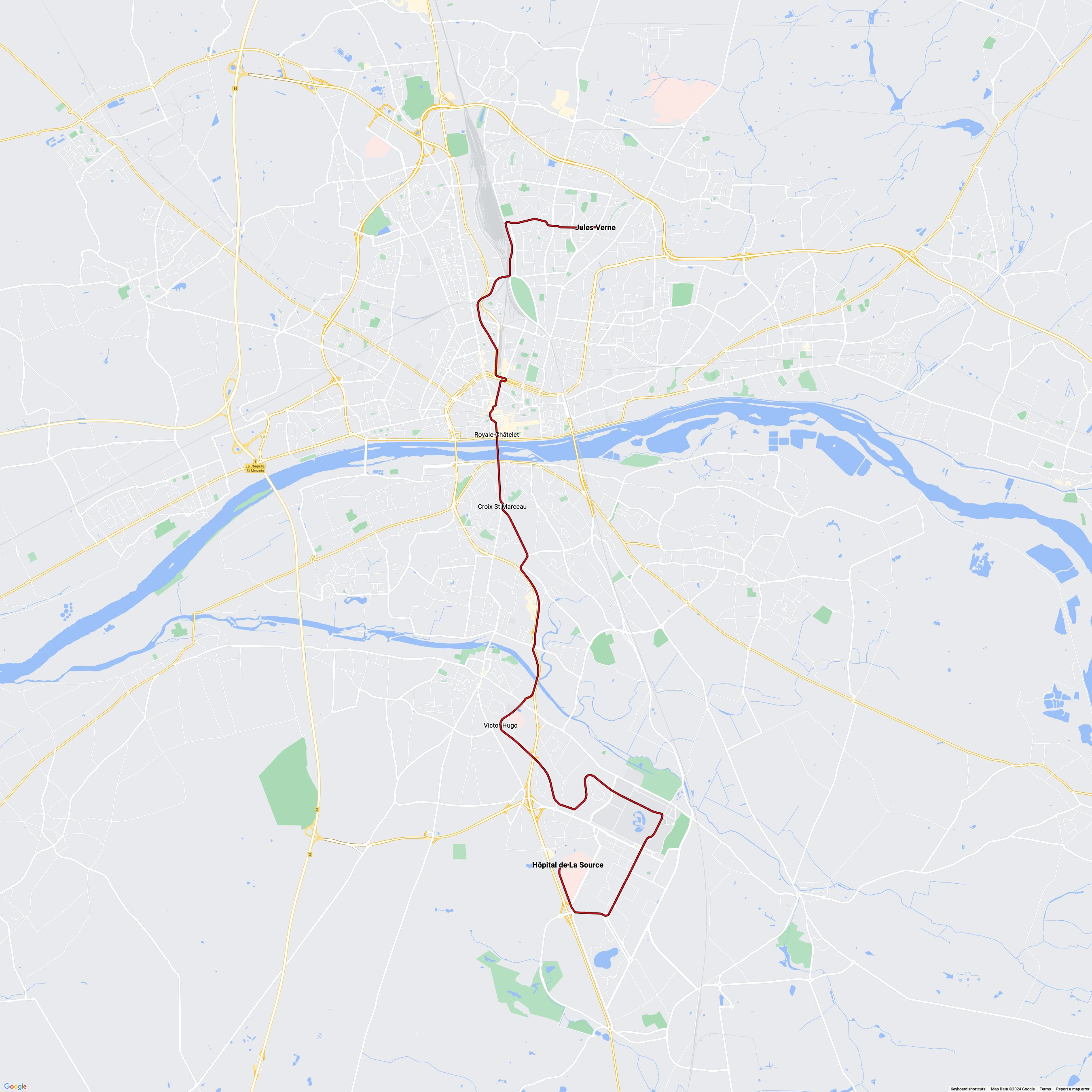
Orléans tram line A: Jules Verne - Hôpital de La Source
Operational
Orléans tram line B
Operational
Transports de l'Agglomération Orléanaise (TAO) stops
Croix St Marceau, Hôpital de La Source, Jules Verne, Royale-Châtelet, and Victor Hugo.

View the route map in high resolution. See the official route map.
Current trams in operation
Low-floor articulated tram: 51, 52.